New research from Portugal aimed to develop an indoor positioning system for use in a museum space where conventional GPS didn’t work. Its overall goal was to identify which area or installation a visitor was currently viewing, so that additional digital material such as explanations, videos or interactive experiences could be offered to them in real time. This was intended to enrich the visitor’s engagement without altering the physical environment of the museum or disrupting its architectural character. The system also needed to be low cost, easy to deploy and discreet, because the building was historically protected and could not be modified to accommodate large infrastructure .

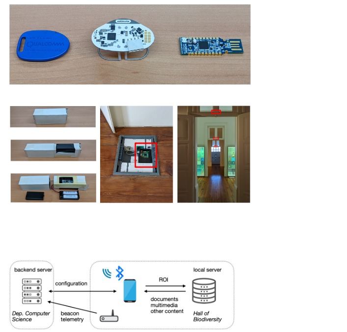
Bluetooth beacons formed one of the main components of the positioning system. They were installed throughout the rooms and central atrium of the museum, each associated with a specific region of interest. The beacons continually broadcast Bluetooth Low Energy signals, and the visitor’s smartphone measured the strength of these signals. Since the signal weakens with distance and is also affected by room layout, objects and walls, the pattern of received signal strengths was used to infer location. The researchers placed the beacons carefully to minimise visual impact, often above doorways or high on walls. Capsules were added to some beacons to direct their signals more reliably and reduce interference caused by reflections from surfaces within the building .
A custom Android application collected both the Bluetooth signal data and video footage from the phone camera as visitors walked through the space. The video frames were later processed to help recognise which room or display was being viewed. For each second of recording, the average signal strength from each beacon was taken to form a consistent data sample. If a beacon was not detected in that second, it was assigned a low placeholder value, ensuring the input dimensions remained stable across the dataset. The video frames were separately used to train image-based models. Both data sources were labelled according to the exact region of interest being walked through at that time, creating the training datasets.
The core scientific aim was to compare positioning models based solely on Bluetooth signal strength with models based on visual recognition, and then test whether combining both improved accuracy. The results showed that while Bluetooth alone could locate visitors with reasonable precision, and video alone could also distinguish rooms effectively, the combination of the two consistently performed better, especially in areas where lighting, open space or multipath signal reflections made a single method less reliable. This demonstrated that using multimodal data can produce stronger and more dependable indoor positioning in complex environments where infrastructure placement is limited.