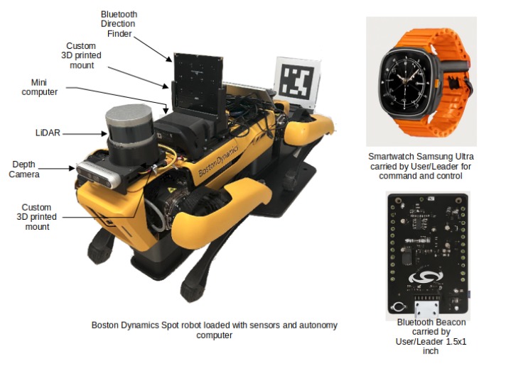
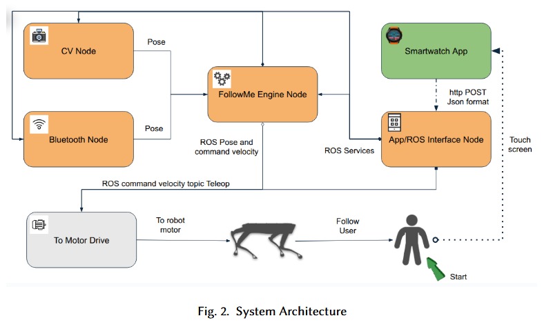
The FollowMe project (pdf) explores the feasibility of using Bluetooth and computer vision (CV) technologies to enable a legged robot to autonomously follow a human operator, with control mediated via a smartwatch interface. While the system ultimately relied on CV for effective tracking, considerable effort was invested in developing and assessing the Bluetooth-based approach.

The Bluetooth component of the system was designed to offer an infrastructure-free method of localisation using Angle of Arrival (AoA) and Received Signal Strength Indicator (RSSI) analysis. The setup featured a Silicon Labs BG22 Bluetooth antenna array mounted on the robot and a BLE-emitting tag carried by the user (emulated via Thunderboard Kits). By measuring the phase of incoming signals from a Constant Tone Extension (CTE) in Bluetooth packets, the system estimated the direction of the tag relative to the robot. This directional information was combined with signal strength data to estimate the distance to the tag, effectively calculating the user’s position in 3D space.

However, this Bluetooth-based tracking system proved unreliable in practice. The AoA method, though theoretically capable of sub-degree resolution, suffered from high noise levels and poor accuracy in real-world conditions. The resulting positional data often diverged significantly from ground truth, with only about 5% accuracy in controlled trials. These shortcomings were attributed to the use of a single locator antenna, multipath interference, and environmental variability. The project team noted that using multiple receivers or integrating inertial sensors might improve robustness, but time constraints precluded further refinement during this study.
It should be noted that commercial systems that rely on Bluetooth Angle of Arrival (AoA) positioning consistently employ multiple locator antennas to achieve accurate localisation. This multi-antenna configuration enables triangulation of the signal source by capturing AoA data from different spatial perspectives, thereby significantly improving the precision and robustness of position estimates. Each locator provides a unique angular measurement relative to its own position, and when these are combined, the system can more reliably compute the target’s location in two or three dimensions. Single-locator setups, by contrast, are inherently limited because they lack the spatial diversity necessary for resolving ambiguity in signal direction and distance.