RSSI vs AoA Bluetooth Asset Tracking

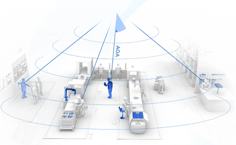
In a previous post on iBeacon Microlocation Accuracy we explained how assets can be tracked using Bluetooth Received Signal Strength (RSSI) or Angle of Arrival (AoA). We advised working out what accuracy is needed prior to seeking out an appropriate solution. However, accuracy isn’t always the only consideration and here is a more complete list of factors.

Accuracy

RSSI asset tracking can achieve accuracies of about 1.5m within a shorter range confined space and 5m at the longer distances. RSSI zone-based systems where beacons are found to the nearest gateway, are accurate to the inter-gateway distance that can be of the order of cm. However having such as large gateway density is usually only practical for very small areas.

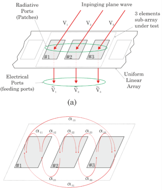
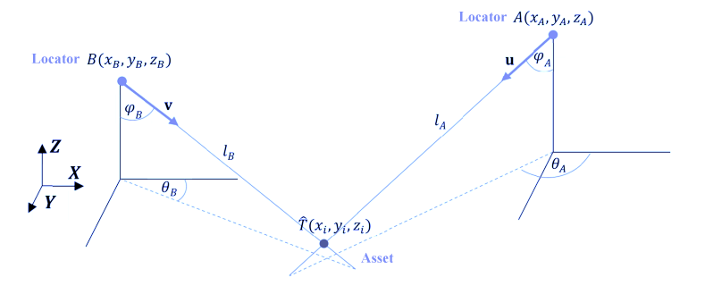
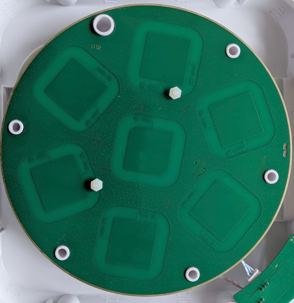
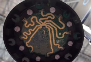
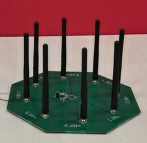
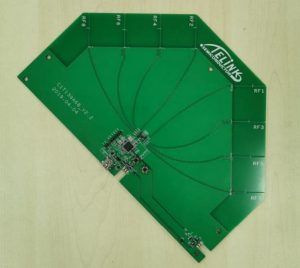
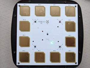
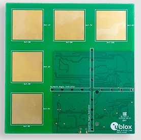
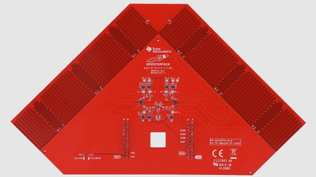
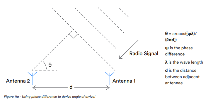
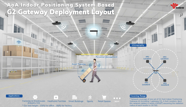
AoA asset tracking achieves sub-metre accuracy. The accuracy depends most on the distance between the locator and beacon but is also affected by the locator hardware quality, radio signal noise, surfaces causing radio reflections, the accuracy of locator placement and beacon orientation.

Maximum number of beacons

AoA-based asset tracking produces and requires much more data which means the locators and software systems have to deal with more data. The data throughput for both types of system depends on the required minimum latency that in-turn depends on how often the beacons advertise. RSSI-based systems support up to high tens of thousands of beacons while AoA supports thousands of beacons.

Beacon variety and IoT

RSSI-based systems can use any beacon and hence support a large range of sensor beacons that can detect movement (accelerometer), movement (started/stopped moving), button press, temperature, humidity, air pressure, light level, open/closed (magnetic hall effect), proximity (PIR), proximity (cm range), fall detection, smoke, natural gas and water leak.

AoA beacons are more specialised and currently only support limited IoT sensing such as movement (accelerometer) and button press.

Cost

AoA locators, gateways and beacons are more complex and are therefore more costly. AoA also needs more locators/gateways per sq area. Hence, AoA systems are x3 to x4 more expensive than RSSI systems.

Setup effort

The accuracy of AoA requires that locators be more carefully positioned than for RSSI, in particular the site and AoA locator positions need to be carefully measured.

Beaconzone supplies both RSSI and AoA systems. Contact us to determine the best type of system for your needs.

Inside the Minew LR1 Locator

The Minew AR1 locator has multiple antenna that receive special constant tone extension (CTE) advertising from beacons.

The Minew antenna consists of 12 PCB patches. If you imagine a radio signal hitting the antenna array from the left hand side, the antennas to the right will receive the signal slightly later. The phase difference can be use to determine the angle.

Martin Woolley’s excellent Bluetooth Direction Finding Technical Overview explains the theory. The main concept is based on simple trigonometry:

In practice, if you do this across just two antenna and with one sample the result has very poor stability. Instead, you need to consider all the antenna patches, over time, as well as perform analysis in multiple directions. This requires use of advanced radiogoniometry techniques.

Minew AoA Kit

Read about PrecisionRTLS™

Minew AoA Direction Finding Kit in Stock

We now have Minew AoA Direction Finding Kit and beacons in stock. The AoA kit consists of a G2 gateway, 4 locators, 3 beacons and interconnecting cables. It covers an area of 400m². Multiple kits can be used to cover larger areas.

The gateway outputs antenna IQ data that’s sent to your server or BeaconZone’s LocationEngine™ for generation of angles.

Read about PrecisionRTLS™

How Accurate is Bluetooth Direction Finding?

Bluetooth direction finding promises sub-meter accuracy. In practice, the accuracy varies depending on factors such as the locator hardware quality, radio signal noise, surfaces causing radio reflections, the accuracy of locator placement and beacon orientation. The sophistication of the location engine software in mitigating some of the aforementioned factors can improve the accuracy.

As a guideline, our Location Engine with the Minew G2/AR1 tends to find beacons with a maximum angular error range between 6° to 10°, depending on the above factors. The error in position due to an error in angle gets magnified with distance from the locator. Hence, the accuracy also depends on the distance between the locator and the beacon.

Here are graphs of error vs distance for 6° error and 10° error:

The above accuracies are for hardware such as the Minew G2/AR1 with PCB antennas 50mm apart. It’s expected that greater accuracies might be achieved with hardware having greater inter-antenna distances.

It can be seen that the sub-meter promise has caveats. We have some tips to help reduce angular errors. Averaging data, over time, also reduces angular error with the trade-off of increased latency of detecting location changes. As with all locating technologies, headline performance claims need to be carefully examined and are only achievable in particular situations.

Read about PrecisionRTLS™

Practical Bluetooth AoA Direction Finding Tips

Bluetooth Angle of Arrival (AoA) uses the phase difference of the radio signal hitting multiple antenna to calculate the elevation and azimuth angles to the beacon.

The accuracy is affected by physical aspects and the way the signals are processed. It varies from the order of a few centimetres to about a metre.

Here are some tips to maximise AoA accuracy:

  • Avoid metal objects close to the locators. Try getting better accuracy by adding boxing above locators to move them away from items such as metal beams.
  • Try to arrange that you have locators on all sides of a beacon. You ideally need locators all around the beacon. Accuracy is poor when the angle between beacon and locator is very large. This includes outside the perimeter of the locators where the angles get progressively larger.
  • The best, of the order of centimetres, accuracy is obtained when the beacon is close to a locator. If accuracy is particularly important, consider dropping the locators down with tall ceilings. Don’t drop too far as remember, from the last tip, accuracy is poor when the angle between beacon and locator is very large.
  • For an x, y z location, the worst accuracy is on up-down z axis. This is because all the locators are usually placed at the same height.
  • Accuracy is best when there’s line of sight between the beacon and locator. This favours the placing of locators on the ceiling/roof and beacons on top of items such as pallet loads.
  • While the physical room usually can’t be changed, be aware when testing that an enclosed space such as an office has more reflections and hence less accuracy than, for example, a warehouse.
  • For most systems, adding more locators in the same area produces more location angles that can be used to calculate a more accurate beacon position. Also try to stagger the locators so they are not in line. More data also means systems can also average the data to mitigate radio noise. However, more data means the location engine supports fewer beacons.
  • Another way to average more data, without stressing the location engine, is to filter over time. However, this increases the latency when receiving location updates.
  • Accuracy varies depending on the beacon orientation. The orientation that gives the best accuracy for one direction, say x, isn’t necessarily the best for y. While there’s usually nothing you can do about this, in some controlled scenarios you can arrange fix the beacon orientation to improve accuracy in a particular direction.
  • Too many beacons, in the same area, advertising too regularly causes Bluetooth packet collisions and loss of radio signal reaching locators. Large beacon populations require a longer beacon Bluetooth periodic advertising period that also has the affect of allowing the system to support a larger maximum number of beacons.
  • Accurate site and anchor measurement is important. Inaccurate initial measurement is a common cause of poor system accuracy. Use a laser measure. If you finding it difficult to measure the x, y location of a locator high up, fix a plumb bob line and measure the location at floor level.

Read about PrecisionRTLS™

Why We Created Our Own Bluetooth Engine

In the post on Bluetooth (BLE) vs Ultra-Wideband (UWB) for Locating we mentioned how Bluetooth 5.1 direction finding solutions have been slow to come to the market and how the products that so far appeared all had shortcomings such we weren’t able to recommend them to our customers.

We spent a considerable amount of time (and cost) evaluating AoA solutions and were disappointed with what we found. While the hardware is generally good, the accompanying location engine software was very poor. This was perhaps understandable because software is not necessarily within a hardware manufacturer’s competence.

A location engine converts radio signals from multi-antenna hardware into x, y z location. There are many ways to implement a location engine using different radiogoniometry algorithms of different accuracy and computational complexity. The location engine also needs to filter the incoming data to mitigate the affects of multi-path reception, polarization, signal spread delays, jitter, and noise. It needs to be flexible to using just one locator or multiple locators for more accuracy. It needs to be performant to support the maximum throughput and hence the maximum number of beacons.

In our evaluations, the location engine wasn’t included in some solutions and where it did exist, it didn’t meet the above requirements. We found evaluation kits to be expensive and in some cases were ‘toys’ that demonstrated the principles but weren’t suitable for production. Most systems had vague performance specifications and it wasn’t clear how well they would scale. Most solutions used dongles for copy protection and some had resource limits linked to payment. Documentation tended to be poor, incomplete and require NDA for something that wasn’t at all commercially sensitive. APIs to access the location engine data tended to be incomplete. Systems were inflexible to beacon input rates and assume everyone needs 100ms updates that kills beacon battery life and severely limits the maximum number of tracked assets. Some only supported 2D rather than 3D locating. Some systems relied on applications polling rather than more efficient streaming the output data. The provenance of the software was unknown and whether it was secure, reliable and free of malware.

The above limitations caused too many uncertainties such that there was no way we could specify, demonstrate and supply to clients. It’s for this reason we created our own location engine that’s performant, flexible, accurate, reliable, secure and documented.

Analysis of location angles for a 12 antenna locator
The peak shows the most likely location

The location engine can be used on its own or as part of PrecisionRTLS™ for plotting onto floorplans, alerts and access to historical data.

Bluetooth AoA Direction Finding

There are many scenarios that require accurate tracking of assets and people. Logistics can ensure efficient use of equipment and improve workflows. Manufacturing can locate valuable plant tools, parts and sub-assemblies, improve safety and enable efficient asset allocation. Healthcare can track high value equipment, monitor the location of medicines, save time searching for equipment and monitor vulnerable patients. Facilities can track valuable assets, monitor lone workers, check occupancy levels and automatically locate people or students for safety and evacuation.

New AoA direction finding brings sub-metre tracking to Bluetooth where the main alternative was previously expensive, proprietary ultra-wide band (UWB). AoA direction finding uses receivers, called locators, that have multiple antenna. The differences in phase of the signal arriving from a beacon to each antenna are used to determine the direction.

One locator can be used to determine the location or multiple locators can be used to triangulate a more accurate beacon position.

You can’t use just any beacon. It needs to send a Constant Tone Extension (CTE) for a long enough time to enable the receiver to switch between all the antennas.

Martin Woolley’s excellent Bluetooth Direction Finding Technical Overview provides a deeper explanation of the theory.

The calculation of data from the antennas to angles is called radiogoniometry. This can be performed by the the same microcontroller hardware that’s receiving the radio data, by a gateway or by a separate location engine on a local server or in the cloud. The problem with using the same microcontroller is that it is slow and doesn’t scale well to larger numbers of beacons. Also, it doesn’t know about other locators and so can’t do triangulation when multiple locators see a beacon.

There are many ways to implement the location engine using different radiogoniometry algorithms of different accuracy and computational complexity. The location engine should also filter the incoming data to mitigate the affects of multi-path reception, polarization, signal spread delays, jitter, and noise. It also needs to be performant, ideally using compiled rather than interpreted code, to support the maximum throughput and hence the maximum number of beacons. It should also also provide a streaming rather than polling API to pass data onto system and applications such as real time locating systems (RTLS).

Read about PrecisionRTLS™

Bluetooth (BLE) vs Ultra-Wideband (UWB) for Locating

We previously mentioned how cost, battery life and second sourcing are the main advantages of Bluetooth over Ultra-Wideband (UWB). An additional, rarely mentioned, advantage is scalability.

Servers that process Bluetooth or Ultra-Wideband support a particular maximum throughout. The rate at which updates reach systems depends on the number of assets, how often they report and the area covered (number of gateways/locators). Each update needs to be processed and compared with very recent updates from other gateways/locators to determine an asset’s position.

For Bluetooth, updates tend to be of the order of 2 to 10 seconds but in some scenarios can be 30 seconds or more for stock checking where assets rarely move. Motion triggered beacons can be used to provide variable update periods depending on an asset’s movement patterns. This allows Bluetooth to support high 10s of thousands of assets without overloading the server.

For Ultra-Wideband, refresh rates tend to be of the order of hundreds of milliseconds (ms) thus stressing the system with more updates/sec. This is why most Ultra-Wideband systems support of the order of single digit thousands of assets and/or smaller areas. More frequent advertising is also the reason why the tags use a lot of battery power.

How does all this change with the new Bluetooth 5.1 direction finding standard? The standard was published in January 2019 but solutions have been slow to come to the market. The products that have so far appeared all have shortcomings that mean we can’t yet recommend them to our customers. Aside from this, in evaluating these products we are seeing compromises compared to traditional Bluetooth locating using received signal strength (RSSI).

Bluetooth 5.1 direction finding needs more complex hardware that, at least in current implementations, are reporting much more often. The server has to do complex processing to convert phase differences to angles and angles to positions thus supporting fewer updates/sec. Bluetooth direction finding is looking more like UWB in that cost, scalability and battery life are sacrificed for increased accuracy. Direction finding locators are currently x6 to x10 more costly than existing Bluetooth/WiFi gateways. Beacon battery life is reduced due to the more frequent and longer advertising. We are seeing Bluetooth 5.1 direction finding being somewhere between traditional Bluetooth RSSI-based locating and Ultra-Wideband in terms of flexibility vs accuracy.

Despite these intrinsic compromises, Bluetooth direction finding is set to provide strong competition to UWB for high accuracy applications. We are already seeing UWB providers seeking to diversify into Bluetooth to provide lower cost, longer battery life and greater scalability.

Bluetooth Asset Tracking

Bluetooth tags/beacons detect the position of people and assets. Software maps jobs, valuable tools, parts, sub-assemblies and people onto your floor plans or maps.

The main uses are:

  • Searching. Knowing the location of something such as a piece of equipment, parts, stock, pallets, a job or person without ringing round. Locating expensive, shared, equipment so fewer spare assets are required to cover an area.
  • Security. Alerting when people or assets enter or leave an area.
  • Protection. Detecting quantities such as temperature and humidity for sensitive items that can spoil.
  • Process Control. Knowing where things have been. Knowing what happened at a particular location. Knowing when measured values exceeded their expected range.

Bluetooth LE is particularly suitable because it is:

  • Real Time. Better than barcode scans and NFC tags where the data is only as up to date as the last successful manual scan.
  • Compatible. Bluetooth LE works with existing devices such as smartphones, tablets, laptops and desktops.
  • Reliable. Works in electrically noisy situations such as the factory.
  • Inexpensive. Commodity hardware is more affordable than non-standard technologies such as ultra wideband (UWB).

The end result is reduced downtime, less time re-ordering or re-making things that have been lost, optimum productivity and better use of skilled staff doing their job rather than searching for assets and people.

Read about Beacons in Industry and the 4th Industrial Revolution (4IR)

Learn about Asset and Pallet Tracking for Manufacturers

Discover BeaconRTLS™

Read about BluetoothLocationEngine™