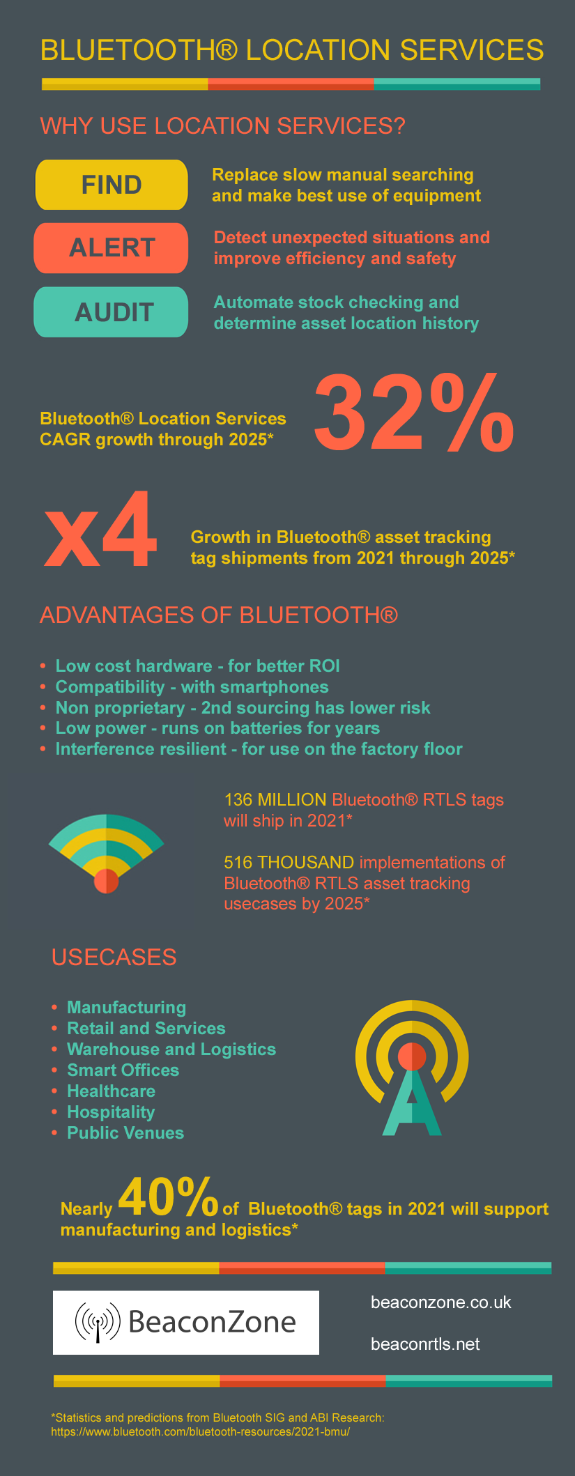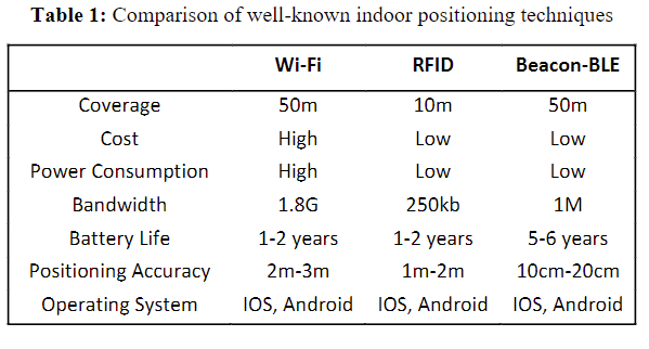
We previously mentioned how cost, battery life and second sourcing are the main advantages of Bluetooth over Ultra-Wideband (UWB). An additional, rarely mentioned, advantage is scalability.
Servers that process Bluetooth or Ultra-Wideband support a particular maximum throughout. The rate at which updates reach systems depends on the number of assets, how often they report and the area covered (number of gateways/locators). Each update needs to be processed and compared with very recent updates from other gateways/locators to determine an asset’s position.
For Bluetooth, updates tend to be of the order of 2 to 10 seconds but in some scenarios can be 30 seconds or more for stock checking where assets rarely move. Motion triggered beacons can be used to provide variable update periods depending on an asset’s movement patterns. This allows Bluetooth to support high 10s of thousands of assets without overloading the server.
For Ultra-Wideband, refresh rates tend to be of the order of hundreds of milliseconds (ms) thus stressing the system with more updates/sec. This is why most Ultra-Wideband systems support of the order of single digit thousands of assets and/or smaller areas. More frequent advertising is also the reason why the tags use a lot of battery power.
How does all this change with the new Bluetooth 5.1 direction finding standard? The standard was published in January 2019 but solutions have been slow to come to the market. The products that have so far appeared all have shortcomings that mean we can’t yet recommend them to our customers. Aside from this, in evaluating these products we are seeing compromises compared to traditional Bluetooth locating using received signal strength (RSSI).
Bluetooth 5.1 direction finding needs more complex hardware that, at least in current implementations, are reporting much more often. The server has to do complex processing to convert phase differences to angles and angles to positions thus supporting fewer updates/sec. Bluetooth direction finding is looking more like UWB in that cost, scalability and battery life are sacrificed for increased accuracy. Direction finding locators are currently x6 to x10 more costly than existing Bluetooth/WiFi gateways. Beacon battery life is reduced due to the more frequent and longer advertising. We are seeing Bluetooth 5.1 direction finding being somewhere between traditional Bluetooth RSSI-based locating and Ultra-Wideband in terms of flexibility vs accuracy.
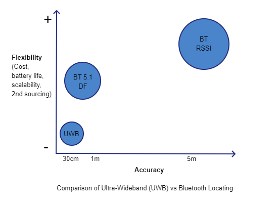
Despite these intrinsic compromises, Bluetooth direction finding is set to provide strong competition to UWB for high accuracy applications. We are already seeing UWB providers seeking to diversify into Bluetooth to provide lower cost, longer battery life and greater scalability.